
Explore Trails
Connecting People to Nature
Get Outside on PLC Protected Land
Part of PLC’s mission is to connect people to nature. We work hard to protect land for public access. Getting outside is good for our health, our communities, our environment, and our economies. We’re proud to continue expanding opportunities for trails across our region. Access to open space and natural areas is critical for our region’s future, and PLC plays an important role in making these places available.
Below you’ll find a map and list of hiking trails where you can get outside on land that has been forever protected by Piedmont Land Conservancy.
Ready to Explore?
1. Knight Brown Nature Preserve | Stokesdale

221 Waterfield Lane, Stokesdale, NC 27357
Right next to Belews Lake there is a piece of quiet, undisturbed land that is PLC’s beloved first preserve. The preserve hosts 6 trails that interconnect in a valley and weave along with a stream that cuts through the forest floor. Find the remarkable views of the bending creek on the Red Trail. Walking all trails gives you a 4.8 mile journey.
- Accessibility: The trail is entirely natural surface with roots and rocks throughout. It begins with a steep descent and has two bridge crossings that require a step or two up and back down.

- Distance: Up to 4.8 miles depending on route
- Type: Trail System
- Difficulty: Moderate
- Highlights: Mature forest, stream
2. Stuart & Emma Thomas Memorial Trail | Winston-Salem

Reynolda Road Trailhead: 1234 Reynolda Rd, Winston-Salem, NC 27104
Dr. CB Hauser Trailhead: 949 Gillete St, Winston-Salem, NC 27105
Downtown isn’t often where most of us think to find a nature trail, but the protected 92-acres of rolling pastures, forested groves, and beautiful views along the Stuart & Emma Thomas Memorial Trail in the heart of Winston-Salem means you don’t need to go far from the city for a peaceful, pastoral experience.
Visitors to the trail will be able to journey up to two and a half miles and take in views of rolling pastures, large oak trees, and views of the Winston-Salem skyline from the high points along the trail. The trail moves over hills and dips that will provide visitors with a few good climbs, but at a gradual pace. Keep your eyes open for the many varieties of birds flitting between the vegetation.
- Accessibility: The trail is entirely natural surface and can be a bit soft and muddy after recent rain. It The trail was designed without steep grades but there are still gradual climbs and descents. The central bridge crossing has a natural surface ramp with a small lip. Both parking areas have one paved, accessible parking space but are gravel lots beyond that spot. Both trailheads have one wheelchair friendly picnic table.

- Distance: 2.5 miles
- Type: Trail System
- Difficulty: Moderate
- Highlights: Rolling pastures, skyline view, wildlife
3. Caraway Creek Preserve | Asheboro

829 Jerico Rd, Asheboro, NC 27205
On the northern edge of the Uwharrie Mountain range, hike up to 4 miles at Caraway Creek Preserve, PLC’s second nature preserve, opened in May of 2023.
The natural surface, hand-built trails meander across beautiful, historic land primarily under tree cover. The hike will give you grand views of surrounding hills in the winter and early spring.
A main feature of the preserve is a historic check dam, seen from the Caraway Forks Trail. This dam was likely built in the early 1900s as a method for silt-retention and flood prevention. It’s large size and considerable craftsmanship are best appreciated in person. Other features of the preserve are mature forests, hikes along ravine edges, and spectacular flora and fauna, as the preserve is located near other PLC protected land.
Please note to check for ticks after a visit, especially in the summer months.
- Accessibility: The natural surface with roots, rocks, and multiple steep areas make this trail very difficult to access.

- Distance: Up to 4 miles depending on route
- Type: Trail System
- Difficulty: Moderate
- Highlights: Historic Dam, Caraway Creek, Bluffs and Ravines, Mature Forest
4. Cane Creek Mountains Natural Area | Near Graham

Pine Hill Trailhead: 5075 Bass Mountain Rd, Snow Camp, NC 27349
Oak Hill Trailhead: 5545 Bass Mountain Road, Snow Camp, NC 27349
The hiking is spectacular at Cane Creek Mountains Natural Area. This natural area is almost 1,000 acres of land protected by PLC.
The natural area has 4 hiking trails (all loops) to choose from, totaling to 9.5 miles of trail if you do them all! Both the Northern Approach Trail and the Lookout Trail journey up to the highest point east of Greensboro. From the top in the winter and early spring months, visitors can get views of the surrounding countryside when the trees have shed their leaves.
Northern Approach Trail
The 2.5 mile trail is a gradual climb up 400 feet which loops back down again. It winds through a beautiful mature forest with unique boulder formations and plant life, and shows off a pristine bubbling creek. This trail begins from the Pine Hill Trailhead.
- Accessibility: The trail begins as a flat, crushed gravel trail but transitions to a rocky and rooty natural surface trail as you being to climb the 400ft elevation gain to the summit.
Longleaf Loop
The Longleaf Loop begins from the Pine Hill Trailhead. The 1-mile loop trail is mostly flat and meanders through an area of new growth, planted with Longleaf Pine trees. Because the vegetation in this area is new growth, the trail has more clear views of the Cane Creek Mountain range.
- Accessibility: The surface of this mostly flat trail is crushed gravel, making it a good option for people with strollers. It's also a favorite of runners.
Pioneer Camp Trail
This 3.4 mile loop begins at the Oak Hill Trailhead. The Pioneer Camp Trail showcases varied landscapes from rocky forested terrain to serene fern beds in the lush lowlands. The trail passes through the old Pioneer Camp, a youth summer camp operating between 1937 and 1956, and offers glimpses of its history like the camp’s chimney and cabin remnants. The detailed work of volunteer trail builders is evident in the rock steps and creative use of the stones found during construction. It’s a beautiful walk in the woods.
- Accessibility: The Pioneer Camp Trail is not easily accessible as it includes stone steps and rocky terrain. The trail does not have any major climbs or descents.
Lookout Trail
The 2.5 mile Lookout Trail was designed with families and beginner hikers in mind. Starting at the Oak Hill Trailhead, it climbs to the top of the highest elevation in North Carolina east of Greensboro but at a leisurely pace, making it easier than the Northern Approach Trail. The forest is beautiful. Towering oaks jut out of the rocky outcrops and boulders of the upland Piedmont Monadnock forest floor. Be sure to look out for the huge leaves of the umbrella magnolia. From the top of the little mountain when the leaves are gone, you’ll enjoy views of the surrounding countryside.
- Accessibility: The Lookout Trail is not easily accessible as it includes stone steps and rocky terrain. The trail climbs some but gradually.

- Distance: The 4 trails range from 1 mile to 3.4 miles.
- Type: Loop
- Difficulty: Moderate
- Highlights: Mountain Summit, Creek, Unique Rock Outcrops
5. Pilot Creek Trail | Pilot Mountain State Park

Get away from the noise and come to Pilot Creek Trail. The mountaintop sections of Pilot Mountain State Park are often stirring with crowds, but not down here. From the small gravel parking lot at the address above, the trail rolls up and down small hills and cuts across little creeks until it connects with the Grindstone Trail and Mountain Trail.
Piedmont Land Conservancy was a major partner in acquiring this land, adding 70 acres to Pilot Mountain State Park. A huge thank you to the Friends of Sauratown Mountains for building the trail. It takes a community to make wonderful places like this a reality.
- Accessibility: Pilot Creek Trail is a narrow natural surface trail. The trail also includes multiple creek crossings with one pictured in the image above.

- Distance: 3.3 miles
- Type: Out and Back
- Difficulty: Moderate
- Highlights: Streams, Woods
6. Faith Rock Trail | Deep River State Trail

Particularly lovely at sunrise and sunset, this 0.74 mile natural surface trail takes you to the top of a 50 foot blue stone outcrop as it juts into the Deep River. Thankfully its beauty will always be here as the preserve is protected in perpetuity by Piedmont Land Conservancy. From the trailhead at the address above, cross the historic bridge and follow the trail through woods with beautiful views of Deep River to the top of Faith Rock, a natural heritage site with rare plants.
- Accessibility: Faith Rock Trail starts with a historic bridge crossing with 7 steep steps up and back down the other side. After the bridge, the trail is natural surface with some sandy sections closer to the river and some rockier sections as the trail gently climbs.

- Distance: 0.75 miles
- Type: Loop
- Difficulty: Easy
- Highlights: River, 50 ft Rock, History
7. Yadkin Memorial Park Trails | Yadkinville

Park Office: 1142 Crystal Lane, Yadkinville, NC 27055
Yadkin Memorial Park East: 2513 Ireland Rd, Yadkinville, NC 27055
Find multiple trail options at Yadkin Memorial Park! The longest, the Ashley Ladd Trail at Yadkin Memorial Park is 3 mile nature trail through the woods and along the lake shore, past the Hood-Chamberlain Dam, and into the newly developed section of the park. This wide trail weaves over streams, through laurels and holly bushes, and past carpets of ferns and eventually out into grassy fields. The trail has gentle ups and downs with places to rest at benches along the way. The park and trail continue to be expanded!
A PLC easement forever protects the 266-acre wooded buffer of land around Yadkin County’s future drinking water supply, Lake Hampton, ensuring clean water and recreation for generations to come.
- Accessibility: Yadkin Memorial Park has a couple trail sections. One is a paved 1 mile loop near the entrance to the park. The Ashley Ladd Trail is a wide and primarily smooth natural surface trail with some small creek crossings (pictured) and a gravel section near the dam.

- Distance: 5 miles of trail total
- Type: Trail System
- Difficulty: Moderate
- Highlights: Lake, Woods, Dam
8. Mayo River Trail and Fall Creek Falls | Mayo River State Park

113 Deshazo Road, Stoneville, NC 27048
At the top of the Triad right next to the State Line, you’ll find your next favorite hike. Passing by a gorgeous waterfall and snuggling into a bend of the Mayo River, this trail is all about the (surprisingly blue) water. It’s part of the Mayo River State Park and is located right along the NC/VA border. Though this hike has a bit of distance, it’s mostly flat. On a warm day you’ll be tempted to lie out on the sandy trail and stay a while.
To learn more about this trail see the guide on the Piedmont Legacy Trails Website.
- Accessibility: The Mayo River Trail starts as a wider hard packed trail with some gravel but has a set of stairs as it reaches Fall Creek Falls. From this point the trail gets narrower and increases in roots and rocks along the trail. Near the river the trail gets very soft and sandy.

- Distance: 1.9 miles (one way)
- Type: Out and Back
- Difficulty: Easy
- Highlights: Waterfall, Forest, River
9. Price Park | Greensboro

1420 Price Park Dr, Greensboro, NC 27410
The 92-acre Price Park is protected by a conservation easement held by PLC and provides a small sanctuary in the middle of a Greensboro suburb. The park features a hiking trail, paved greenway, and a bird and butterfly sanctuary. The 1-mile Evergreen Trail (pictured) winds through a lush forest while the 1-mile Price Park Greenway follows along the creek with more open views.
- Accessibility: The Evergreen Trail has a short-lived wide smooth section going clockwise from the library. It then turns into a slimmer path with rocks and roots. The Price Park Greenway is paved and more easily accessible.

- Distance: 2 miles
- Type: Trail System
- Difficulty: Easy
- Highlights: Forest, plant life, meadows
10. Black Walnut Bottoms Trail | Bethania

5393 Ham Horton Ln, Bethania, NC 27010
The Town of Bethania is a historic destination near Winston-Salem, with a wealth of trails to offer. PLC has worked closely with community to conserve the land around the town to create pockets of solace. The most easily accessible trail is Black Walnut Bottoms Trail, a 1.4 mile natural surface trail starting at the Bethania Visitor’s Center, address above. The trail follows along Muddy Creek and cuts through forest and open fields.
- Accessibility: Black Walnut Bottoms Trail is natural surface but has many sections where the trail is over grass. Additionally there are a few bridges with steps up and down as well as stairs leading down from the parking lot to the trailhead.

- Distance: 1.4 miles
- Type: Trail System
- Difficulty: Easy
- Highlights: Forest, plant life, meadows
11. Wells Knob Trail | Elkin

Elkin, NC
Wells Knob Trail is a lovely 3 mile hike through the woods that will get your heart pumping. This trail is also open for trail users on horseback! The entire trail is 3.2 miles over the knob and down to the other side. If you hike up to the summit and turn back the way you came, that will also get you approximately 3 miles. The climb is an elevation gain of 735 feet.
We suggest starting this hike from the north side of Wells Knob because of the availability of parking. Turn onto Wits End Road from Roaring Gap Road and park on the left, before crossing the bridge. You will see a sign that says “Wells Knob Parking” along with other information. Please do not block the road or the dumpster when parking. The exact coordinates of the parking lot are (36.33939, -80.94693). Google Maps lists the location as “Wells Knob Trailhead.”
After parking, cross the bridge over Elkin Creek on foot along the gravel road. Before long, you will see the trail begin off the road on your right. Look for an MST sign with the white circle trail marker. From this point the trail is a marked natural surface trail up to the summit.
On the downslope of the southern side of the knob, the trail becomes a gravel road. Many people opt to turn around once reaching the summit and to head down the way they came back to their car.
- Accessibility: This natural surface trail begins as a narrow dirt path with roots and rocks. As the trail begins to climb it widens but becomes steeper and rockier. On the the southside of the Knob the trail becomes a gravel road.

- Distance: 3 miles
- Type: Out and Back
- Difficulty: Moderate
- Highlights: Mountain Summit, Stream, Beautiful Flora
- Users: Equestrians & Hikers
12. Long Creek Park | Winston-Salem

5801 Bethania Tobaccoville Road Winston-Salem, NC 27106
Long Creek Park, once a golf course, is managed by the City of Winston-Salem. As of 2024, PLC holds a conservation easement of 63 acres of the park.
The trail begins at the address above with plenty of parking. There is a very nice picnic shelter as well as a public pool. Restroom facilities are only available when the pool is open.
The trail is mostly an old golf cart paths with some sections of natural surface. There are three road crossings. The trail mostly cuts through open fields with a few sections of shade.
This park is noted as being great for bird watchers.
- Accessibility: This is made from old golf cart paths. The trail is mostly paved with lots of cracks and grass growing through in sections. There are some sections that are dirt. The trails also has a few steep hills. The bridges across the creeks are wooden and have some sizable gaps between planks.

- Distance: 4.7 miles
- Type: Trail System
- Difficulty: Moderate
- Highlights: Bird Habitat, Creek, Open Fields
- Users: Hikers
13. Ridges Mountain | Asheboro
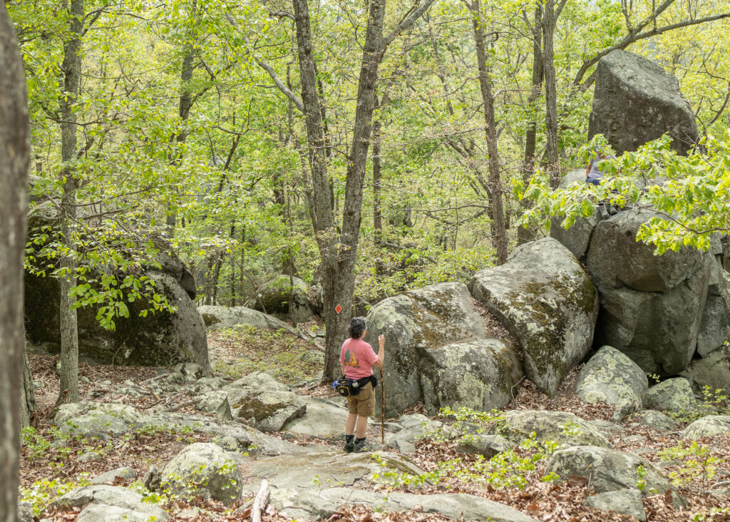
504 Summit Court Asheboro, NC 27106
Ridges Mountain has been protected through a partnership between Piedmont Land Conservancy, the North Carolina Zoo, and the Conservation Fund. The preserve is currently managed by the NC Zoo.
To hike this trail or climb the boulders, you must make a reservation on the NC Zoo website. Click here to make a hiking reservation. Click here to make a climbing reservation. The reservation system makes sure that this sensitive habitat is not over crowded. Thank you.
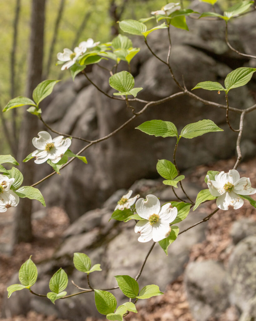
As of 2025 this preserve is now up to nearly 500 protected acres and is a truly special ecosystem in our region. Reaching 840 feet in elevation, Ridges Mountain consists of mature hardwood forests and wetlands that provide important habitat for wildlife and plants. The crowning feature of Ridges Mountain is the massive boulders located at the summit that offer views of the surrounding landscape. The 2-mile trail follows the ridgeline of the mountain to the summit and then loops back down, highlighting interesting rock formations along the way. This is a natural surface trail that is rocky and contains some steeper slopes. No pets are allowed.
- Accessibility: The beginning of this trail starts on a wide, mostly flat old road bed. Once the beginning spur reaches the loop trail the trail becomes much thinner and rockier with hikers needing to watch their step. This section of the trail is not suitable for OtherPower-Driven Mobility Devices.
- Distance: 1.8 miles
- Type: Lollipop Loop
- Difficulty: Moderate
- Highlights: Large Boulders, Diverse Forest, Vernal Pools
- Users: Hikers, Climbers, Dogs are not allowed
Find more trails through Piedmont Legacy Trails
Together with the Piedmont Triad Regional Council we created Piedmont Legacy Trails, the trails collective in the Piedmont Triad whose primary goal is to highlight our natural places, connect trail efforts, and give voice to regional trail interests for the the benefit of our communities.


